
Tournament Baseball!
This page will be updated shortly.
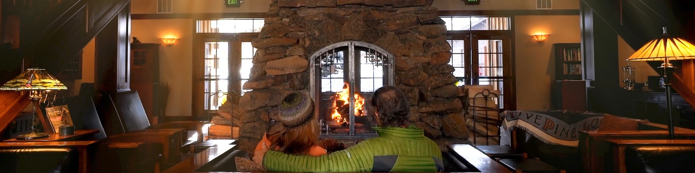
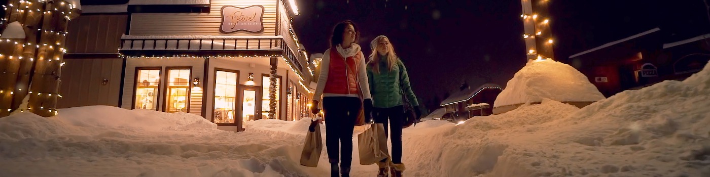
PLACES TO STAY
IN TOWN LODGING
Contact
For more information about Sisters and Central Oregon, please come in, call or email us... we'd love to assist you with your specific needs.
 |
Please contact Turi for Membership, Marketing or Billing turi@sisterscountry.com |
 |
Please contact Kathy for Event or Business Information (including calendar and newsletter submissions) kathy@sisterscountry.com |
 |
Please contact Judy for Business Assistance, Advocacy or Grants judy@sisterscountry.com |
Sisters Area Chamber of Commerce
PO Box 430
257 S Pine Street, Suite 102
Sisters, OR 97759
Local: (541) 549-0251
ARTS & CULTURE
RECREATION AND ACTIVITIES
TRAILS AND MAPS
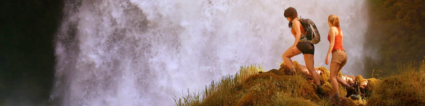
The Sisters Country is home to the best hiking, biking, camping, backpacking and outdoor adventure activities in the Northwest. Play in our 1.6 million acre backyard, called the Deschutes National Forest. If you're looking to get away in central Oregon, this is your resource.
Click here for the Summer Quick Reference Trail Guide (PDF)
Click here for the Winter Quick Reference Trail Guide (PDF)
Be sure to download the Day Use Guidelines before you head out on your Sisters Country Adventure!
Birding Trails (PDF)
Disc Golf (PDF)
Click to download our Complete Trail Guide » (PDF - 33.5MB)
Click to download our Complete Summer Trail Guide » (PDF - 19MB)
Click to download our Complete Winter Trail Guide » (PDF - 16.7MB)
OUTLAW ACADEMICS
Sisters High School has been designated a "School of Excellence" by the state of Oregon, awarded an "Accredited with Merit" certification by the Northwest Association of Schools and Colleges, and earned an international accreditation designation. Check out the state report card for Sisters High School here. (PDF)
Sisters High School offers six career academies. Students are required to take elective credits in a career academy of their choice. The goal is to make education more meaningful and thoughtful for students. A variety of programs suited to the unique interests of the student body account for part of Sisters High School's success. There are many unique, grant-funded programs offered throughout the Sisters Schools which help to make this an extra special place.
The High School's college preparatory math programs integrate math concepts from everyday life into classroom lessons. Course offerings of algebra, geometry, trigonometry, probability, and statistics build toward college-credit level calculus.
The science program incorporates laboratory work, chemistry, physics, biology, astronomy, and wilderness ecology. The Sisters Science Club, a group made up of retired professors, doctors, and more have developed a co-curricular learning model that supports all sciences taught within the Sisters School District. The Sisters Science Club also hosts the annual Science Fair every year in February.
Other co-curricular learning opportunities for students interested in math and sciences include:
- Interdisciplinary Environmental Education (IEE)
- Sisters Science Club
- Lego Robotics
- Flight Science
- Fire Science
Business, multi-media, and other training classes prepare students for the world beyond the classroom:
- Information systems management
- Software applications
- Culinary arts
- Computer-aided design
- Web design
- Foreign language including Spanish and Mandarin
- Video production
- Woods and technology
Unique Programming & the Arts
Sisters Schools are well-supported through unique and innovative programming that help make the school experience memorable for all students. Unique, grant-funded, learning programs include:
- Interdisciplinary Environmental Expedition (IEE)
- Americana
- Mandarin Chinese
- Luthier Guitar Building
- Flight Science
- Fire Science
- Culinary Arts
SISTERS HIGH SCHOOL LUTHIER PROGRAM
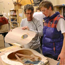 Outlaw Guitars
Brief History of the Sisters High School Luthier Program
In 2005, Mr. Tony Cosby, Sisters High School Computer and Construction Teacher, wanted a class that would motivate his advanced students. He felt that a guitar class would be a perfect fit. In Woodworking II, students work throughout the whole trimester constructing guitars. Working with the help of one of the best Luthiers (guitar makers) in the northwest, Jayson Bowerman (Breedlove Guitars), they have been able to produce 30 guitars per year.
After the students complete their guitars, they are given the choice to keep their guitar or sell them with the school's help.
Many students that choose to keep their guitars, continue to use them to learn to play traditional folk music in the Sisters High School Americana class. Others dontate their guitars to raise funds for school programming.
Click here to be re-directed to the Sisters High School Woods Program website to learn more.
INTERDISCIPLINARY ENVIRONMENTAL EXPEDITION
 Outlaw Interdisciplinary Environmental Expedition (I.E.E.)
The Interdisciplinary Environmental Expedition (I.E.E.) course is composed of a community of learners working together to gain a balanced, in-depth understanding of the world around them.
Using an integrated approach, students will be provided with the educational opportunity to study and learn about the natural environment through a hands-on format. Students will learn critical thinking skills experientially by applying knowledge and skills to their surroundings. Students will be given the necessary tools to create positive change within their community and possibly even the world around them.
This course is committed to developing community partnerships that result in a shared vision of stewardship and a sense of appreciation for and responsibility to the world around us. Above all, this course is committed to providing non-traditional education that not only challenges students, but makes learning relevant.
Core Beliefs of the I.E.E. Program and Leadership
Learning and understanding will increase when students can see and apply connections to relevant situations.The key concepts of stewardship and responsibility can truly be learned by experiencing and problem-solving within the natural environment. To solve contemporary and future problems, students must develop and practice teamwork skills. Experience-based learning develops knowledge and skills necessary to facilitate future decision-making. Active learning promotes awareness and appreciation of our environment. A love and respect for the natural environment must be developed and nurtured. Knowledge and practices nurtured at this time, promote lifelong health, wellness, and learning.
Program Components:
Students at the Junior level at Sisters High School are eligible to participate in the I.E.E. program which covers three subjects: English, Environmental Science, and Outdoor Recreation in the period of 2 trimesters. Students spend a two-period afternoon block working on this program which build up to two major 3-day expeditions and numerous field study opportunities.
Students, parents, teachers and community members say there are many benefits to the I.E.E. Program including:
- Career Preparation
- Easier transition to college or career
- Teamwork and teambuilding exercises
- Utilizing critical thinking skills
- Relevant education
- Helped to give students a sense of place and tie them in with their own community
- This program has helped to foster community partnerships
- Raised the bar with students, for example, and demanded excellence.
- Students are required to give presentations to community audiences (other than their peers) which encourages public speaking and preparation skills.
- Teaches students to be open-minded and look at multiple sides before making a decision.
- Decision and critical thinking skills based on research.
- Encourages awareness in community activities.
- Showcases to students they can have a voice in community events and public process.
- Students receive 3 credits (vs. the normal 2)
Click here to be re-directed to the Sisters High School I.E.E. website to learn more.
OUTLAW ATHLETICS
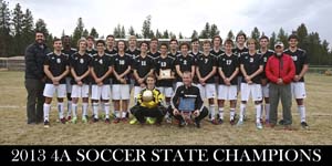 Despite being one of the smallest 4A schools, Sisters High School repeatedly produces state champions in football, soccer, lacrosse, volleyball, golf, swimming, cross-country and track.
Supported in part by the Sisters High School Outlaw Booster Club, Friday night football games, varsity baseball, volleyball, lacrosse and more are certainly a community event!
Tim Roth, Athletic Director from Sisters High School is proud to say: "We purposefully categorize Sisters Athletics as "co-curricular", not "extra-curricular" because, as a coaching staff, our goal is to be an integral part of the teaching mission of our school. Our coaches believe that their work is an extension of the classroom."
Click here to be re-directed to the Outlaw Athletics Home Page to learn more.
AMERICANA PROJECT
The Americana Project is an innovative music and arts education program with deep community outreach. Classes each day at both Sisters High and Middle schools provide opportunities for self-expression in music and many visual-arts mediums.
Students learn to play guitar, write songs, record, engineer, perform and, through the Community Luthier program, build custom guitars and ukuleles. Young people in Sisters also work with national, regional, and local guest artists, where they are mentored and great insight is shared on life as an artist, from the business to the art form.
From kindergarten through high school, kids in Sisters are exposed to and have immersive experiences in all aspects of Sisters Folk Festival programming. Through their exposure to guest artists, guitar- and ukulele-building, and participation in My Own Two Hands, young children expand their thinking to see the arts as a lens through which to view life, and a poet’s perspective as being valuable.
These young folks participate in classes, community events, and song-writing academies that enhance their skill-sets and artistic vision. Select high school students have the opportunity to teach, mentor, and intern in community radio, recording/engineering, and with the Sisters Folk Festival organization. Many of our alumni go on to find meaningful work in artistic endeavors as recording artists and engineers, performers, luthiers, graphic designers, and teachers. Students for over a decade have received scholarships as well as providing great service within the community.
The Americana Project also includes outreach programs and opportunities for participants including the Americana Song Academy and Academy for Youth provided by the Sisters Folk Festival.
Click here to be re-directed to the Sisters Folk Festival Americana Project website to learn more.
Sisters High School Flight Science Program
Sisters High School Flight Science course introduces students to the world of sport aviation through a unique partnership with Sisters Eagle Air, the Sisters Science Club and other partners.
All enrolled students begin as "Young Eagles" in the Experimental Aircraft Association's (EAA) training program and get a free one-hour flight with a certified flight instructor (CFI). Students also receive logbooks and additional supplies donated from Sporty's Pilot Shop, the largest aviation supply shop in the country.
Each student will receive one hour of flight training per week for the 30-week course, this will fulfill half of the requirements for flight time for each student to receive a private pilot's license. Upon successful completion of the class, students will have finished all the ground-school requirements needed for this same license.
Students have the option to articulate this class with Central Oregon Community College (COCC) aviation program to work toward their first-level commercial license.
Contact the Sisters School District Office at 541-549-8521 for additional information on the Flight Science program.
Arts Programming at Sisters Schools
Supported in part by Sisters' thriving community of artists and musicians, the high school art program includes painting, design, ceramics, sculpture, music, theater arts, jewelry-making, and photography.
Music classes are top-notch throughout the Sisters Schools, and the unique Americana Project, the educational outreach program of the Sisters Folk Festival helps to teach students to play guitar, write and record their own music, and much more.
Sisters High School is also proud to offer a culinary arts program that is top-notch. Classes include Cooking with Comfort, professional baking, culinary essentials, international foods, and much more. Students even get real-world experience when they have their own opportunity to run the "Outlaw Cafe."
Many of the programs offered at the high school in the visual and performing arts are supported in a modified fashion in both Sisters Middle School and Sisters Elementary School.
Click here to learn more about the Visual Arts.
Click here to learn more about the Performing Arts.
Click here to learn more about Culinary Arts Program.
Outlaw Mandarin Chinese
Chinese
We offer Chinese in six levels in the Sisters School District. Students can begin Chinese at the Middle School, as early as the seventh grade, and can complete two years of Chinese for high school credit before beginning the ninth grade at the high school. They can merge into Chinese 3 at that time, if they so choose that option. Students who begin Chinese upon entering high school can complete up to four years of Chinese, if they so choose. Chinese 4 and 5 are AP courses. In addition to David Perkins, we have three native speaker Chinese teachers sponsored by Hanban, a part of the China Ministry of Education.
Our curriculum uses a text and workbook entitled “Easy Steps to Chinese” and corresponds to ACTFL standards. Students who continue their Chinese study in college are often able to quiz out of Chinese levels 1 and 2 at college level.
Also beginning in 2017, through working with the GRO scholarship program, we are offering scholarships to graduating seniors who plan to either major or minor in Chinese in college, and who have taken a minimum of two years of Chinese at Sisters High School. We are very excited about this new opportunity!
Chinese Teacher Bio: Ada Chao, originally from Taipei, Taiwan, immigrated to Bend, Oregon in 1989. She received her undergraduate degree from the University of Oregon. Masters in Education from Michigan State and Masters in Teaching from Pacific University. Ms. Chao taught in Kaohsiung, Taiwan for seven years before moving back to Central Oregon.
Click here to be re-directed to Foreign Language Department page on Sisters High School's website >>
Click here to go back to Outlaw Academics >>
Sisters Elementary School
Sisters Elementary is a high-performing academic school enriched by generous community support. The school provides a well-rounded curriculum in academics and the arts. Students receive strong instruction in reading, math, and writing with regular monitoring of progress and opportunities for remediation and acceleration. They participate in physical education and music classes each week on alternate days. There is an emphasis on making learning fun in an environment that is highly respectful and safe.
According to Principal, Mark Stewart, "the core of Sisters Elementary is relationships - every student, every day! Our goal is to build an authentic foundation on relationships, community, culture, and trust. Honestly, a place where students and staff want to be. With this foundation, we can take the wonderful journey of learning anywhere!"
Sisters Elementary is a K-4 school offering small class sizes and an excellent staff. Our Title 1 reading program provided by a reading specialist is exemplary in its ability to help students reach grade-level standards and provide assistance to teachers to ensure quality reading instruction throughout the grade levels.
Sisters Elementary provides a very nurturing environment that upholds high academic and behavior standards. The staff takes pride in their love for children and giving the gift of learning.
Click here to be re-directed to the Sisters Elementary School website to learn more >>
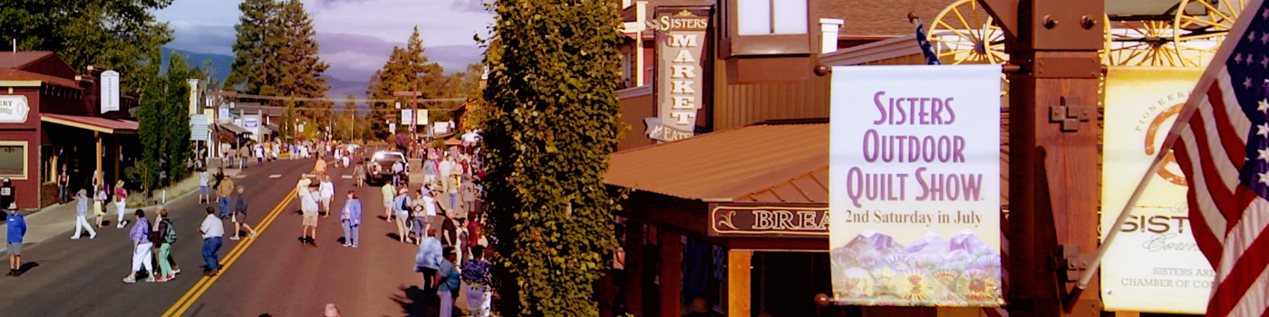
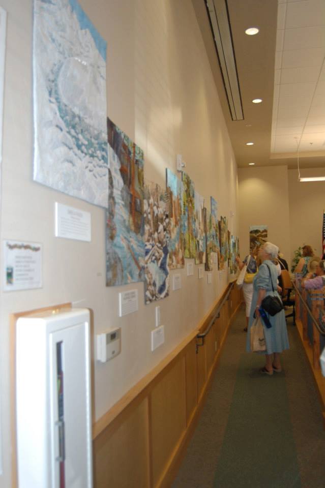
THE ANNUAL SISTERS OUTDOOR QUILT SHOW
The "World's Largest Outdoor Quilt Show" is always the second Saturday in July.
Join us Saturday, July 13, 2024 - Please check the quilt show website for updates.
More than 1300 quilts will be on display, representing fiber artists from around the world.
Visit the quilt show's website for more information: https://www.soqs.org
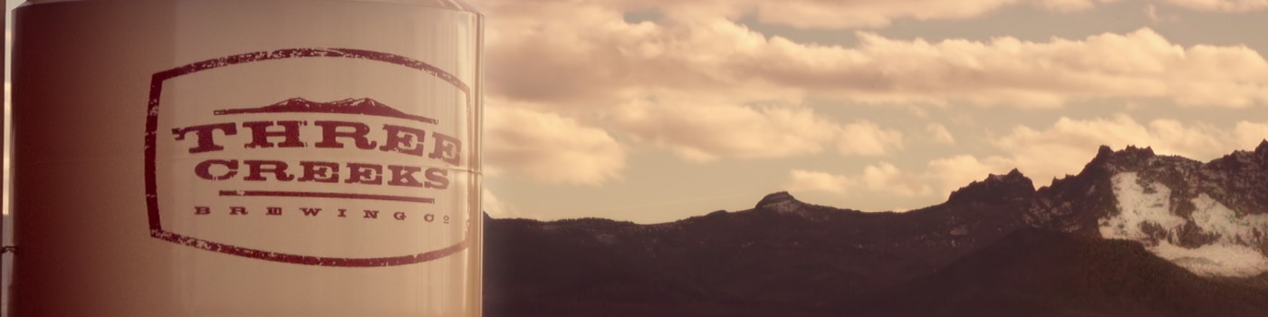
BEER/WINE/LIQUOR
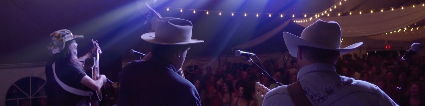
THE ANNUAL SISTERS FOLK FESTIVAL
Join us this September 26-28, 2025
Please check the SFF Presents website for updates and more information: https://www.sffpresents.org
SISTERS COUNTRY PUBLIC ART
There has been a concerted effort in Sisters to promote an arts-based economy. Organizations like the Sisters Outdoor Quilt Show, Sisters Folk Festival Inc., the Roundhouse Foundation and local businesses have helped put Sisters on the map for its events, art galleries and the talented group of artists and musicians that call the area home.
Quality arts education in the public schools, including Sisters Folk Festival’s, Americana Project provides instruction in a wide variety of arts and music classes from quilting to building a guitar. When students leave the Sisters Schools, they have been exposed to a myriad of arts-related classes. Many choose to pursue higher education and careers in the arts. Families move to Sisters for the excellent public schools and stay for the recreational and cultural opportunities in this small town with big ideas.
Over the past few years, the City of Sisters and the Public Art Committee have worked hard at developing a unique collection that both enhances the 1880s theme of the Sisters community and honors the rich heritage of Sisters Country. Below is a list of Public Art installations, their artists, and locations.
| Photo | Description | Address |
 |
Two Rivers, Three Sisters Quilt Installation. 17 pieces over 40 feet long a depiction of Whychus Creek running through Sisters
What is Quilt for Two Rivers all about? |
City Hall |
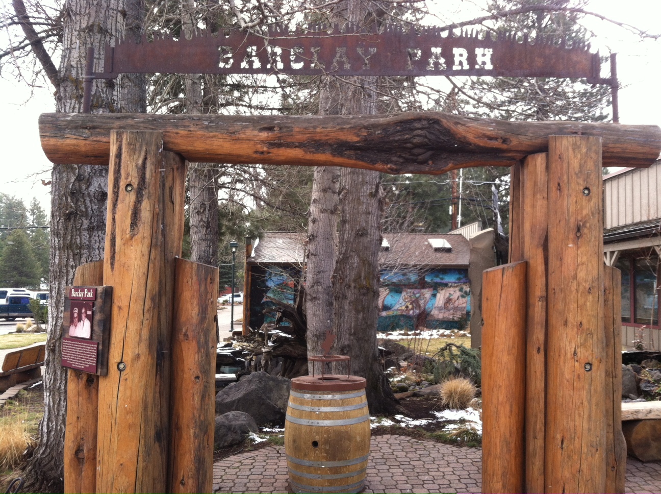 |
The entrance to Barclay Park has a timber archway, celebrating Sisters logging heritage and the contributions to Sisters by the Barclay Family. | Barclay Park, corner of Ash & Cascade |
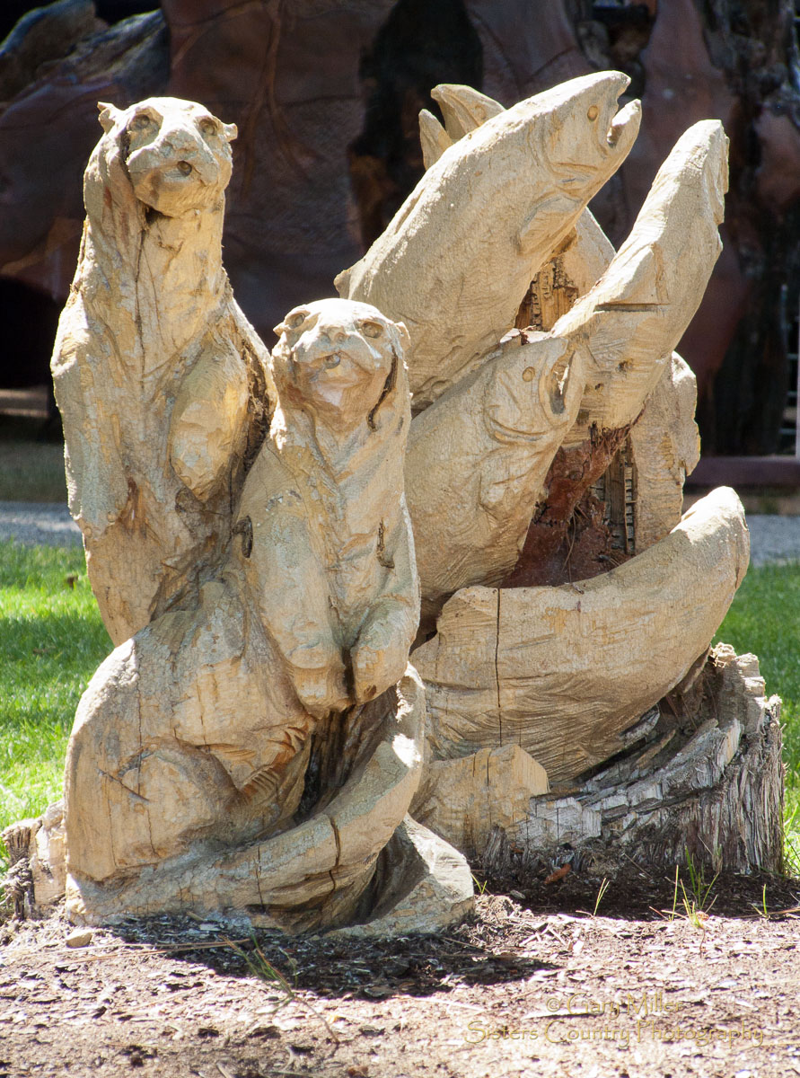 |
Near the water feature in Barclay Park sits a sampling of J. Chester 'Skip' Armstrong's masterful chainsaw carvings depicting creatures we find in Whychus Creek. | Barclay Park, corner of Hood & Ash Streets |
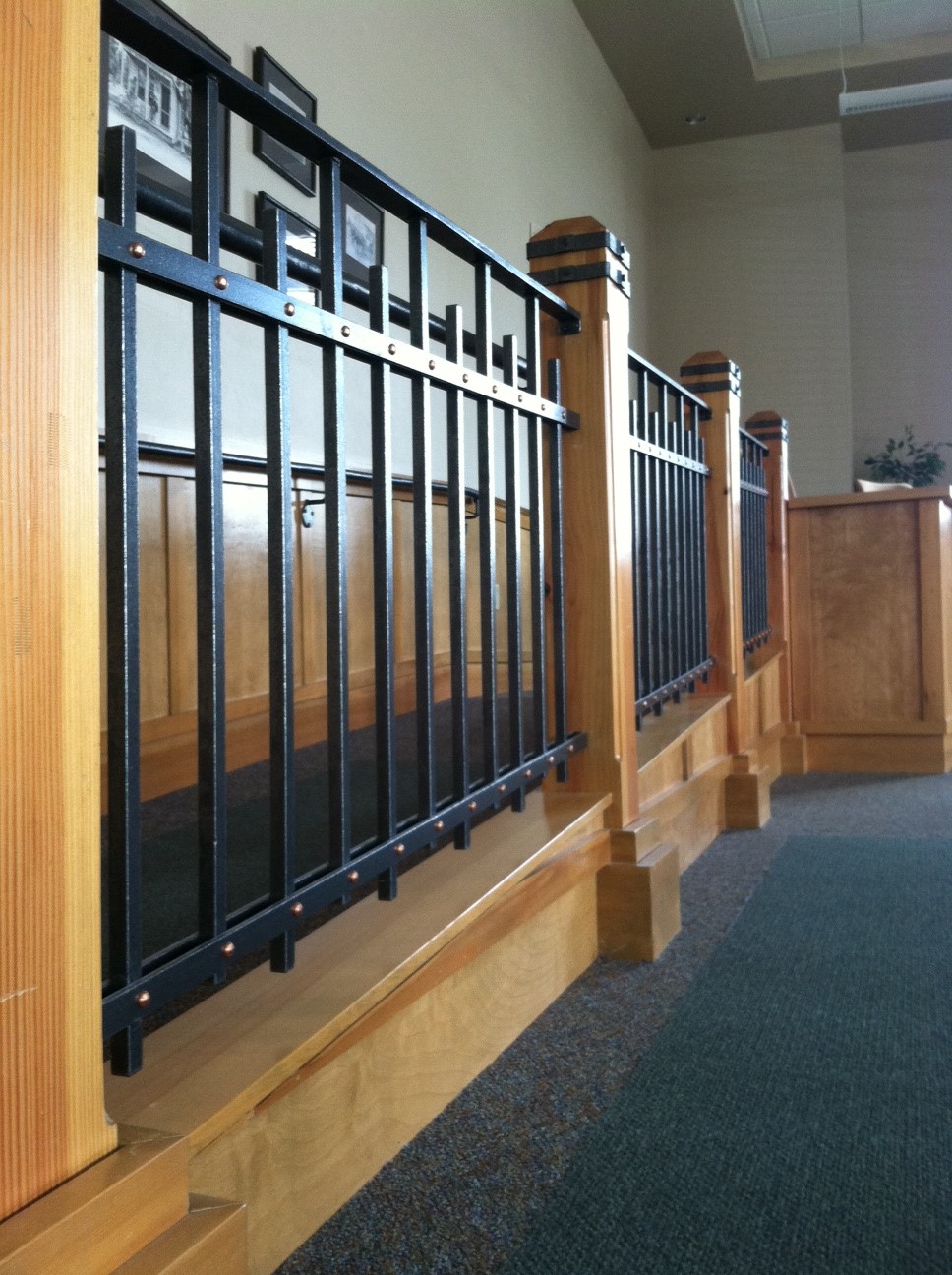 |
The City Council Chambers shows off the exquisite ironwork of Jeff Wester, owner of Ponderosa Forge & Ironworks. | City Hall, 520 E Cascade Ave |
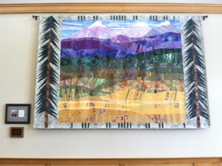 |
Within City Hall hangs a lovely quilt, created by Jean Wells, celebrating Sisters majestic landscape. | 520 E Cascade Ave. |
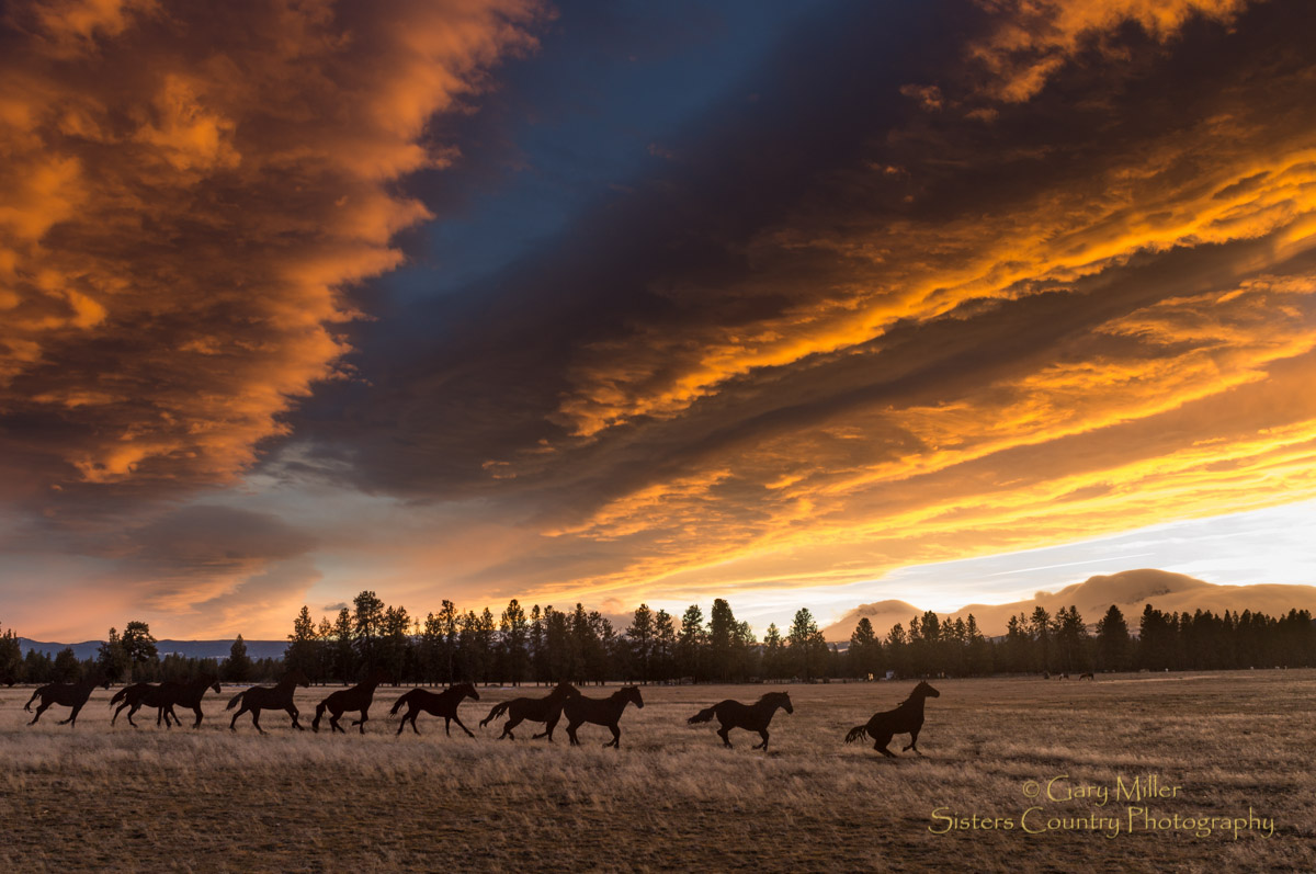 |
From Hwy 20, on the Lazy Z, one can see our iconic 'Running Horses' created by Brian Bain of Culver. This work commemorates Sisters ranching and equestrian heritage. Photo by Gary Miller | Hwy 20 1.5 miles East of Sisters |
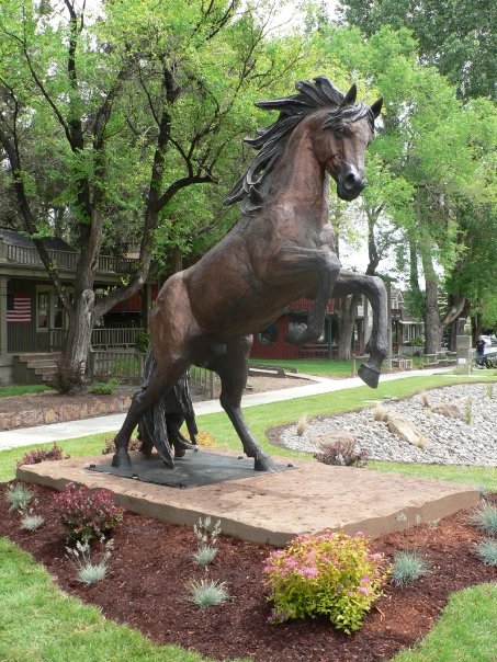 |
At Cascade and Spruce, Sisters Outlaw spirit is celebrated in the equally iconic Wild Stallion Sculpture created by world-renowned artist Lorenzo Ghiglieri | Corner of Cascade and Spruce. |
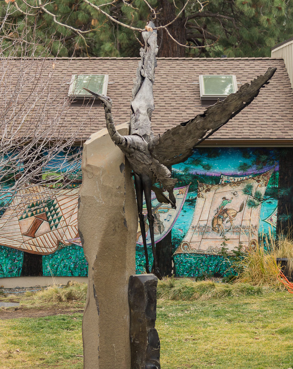 |
The newest artwork was dedicated in December 2012, a bronze heron, created by Danae Miller. Photo by Gary Miller. | Barclay Park, Corner of Ash and Cascade |
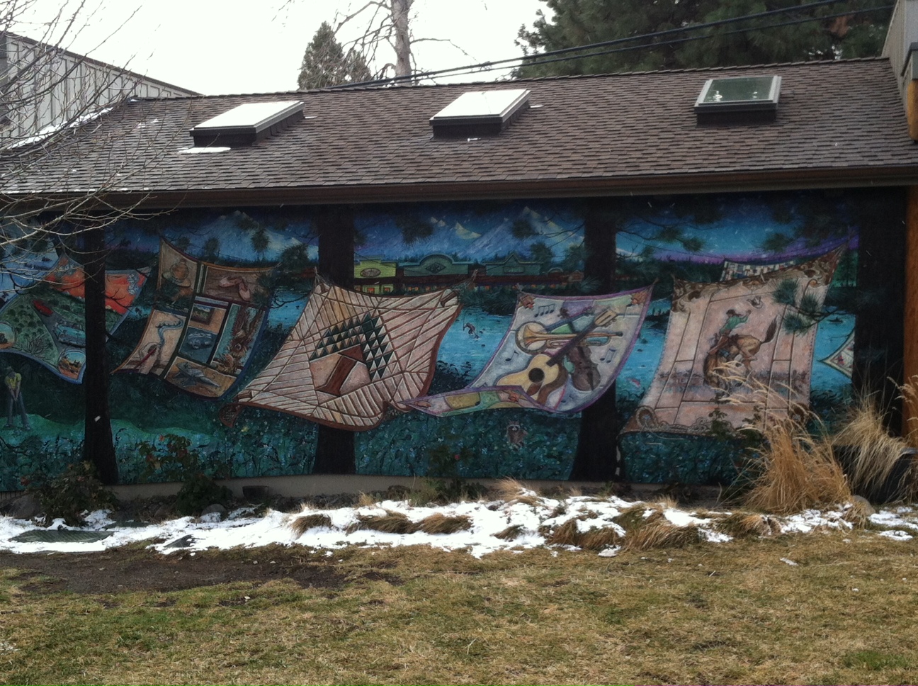 |
At Barclay Park, we enjoy a mural of quilts, created by local artist Jerry Werner, celebrating all that Sisters is as a community. Photo by Gary Miller. | Barclay Park, corner of Ash and Cascade |
ROCK CLIMBING
Carabiners? Check.
Petons? Check.
Cams? Check.
Climbing rope? Of course.
Now go explore one of the NorthWest's greatest climbs -- "monkey face," aka the cliffs and trails at Smith Rock.
Smith Rock State Park PDF (243k)
FISHING
Heaven found at the foot of flowing waters...
- McKenzie River Trail PDF (254k)
- Metolius River Trail PDF (589k)
- Suttle Lake Shoreline Trail PDF (1.2mb)
For guided treks and tours visit one of our local operators.
The Fly Fishers Place - 541.549.FISH
HORSE TRAILS
Here are a few of the horse-friendly areas and trails in Sisters Country...
- Butte Loops Trail PDF (1.8mb)
- Eagle Rock & Peterson Ridge Trails PDF (1.6mb)
- Green Ridge Trail PDF (670k)
- McKenzie River Trail PDF (254k)
- Metolius River Trail PDF (589k)
- Sisters Mountain Bike Trail PDF (1.2mb)
- Suttle Tie Trail PDF (1.7mb)
- Tam MacArthur Rim PDF (253k)
- Three Creeks Trails PDF (264k)
Trail Riding Programs are available at:
BIKING
Miles and miles of terrain found here in these great biking trails -- all in The Sisters Country...are you a road cyclist? Don't worry...scroll down for some of the area's best Road Cycling Routes!
Click here for the quick reference guide to summer trails in and about the Sisters Country.
Only have time for one Mountain Bike ride? Here are the best of the best...
- Peterson Ridge Trail System
- Suttle Tie Trail PDF (1.7mb)
Other amazing Mountain Bike Trails in Sisters Country...
- Green Ridge Trail PDF (670k)
- McKenzie River Trail PDF (254k)
For current trail conditions in Sisters Country - and to try to find the favorite local hot spots - check out Sisters Country's local bike shops!
Looking for Road Cycling? Look no further...Sisters has three Scenic Bikeways (learn more about all the state scenic bikeways here)! Click here for more information on Cycling Sisters Country.
Don't miss out on the new Sisters Community Trail System - brought to you by the Sisters Trails Alliance. Miles and miles of biking trails abound right from town!
NORDIC TRAILS
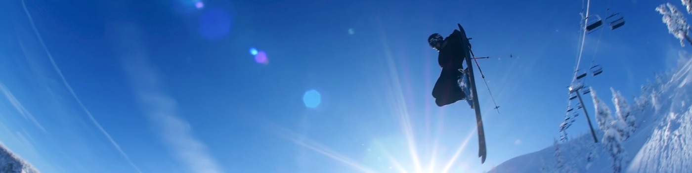
Looking to get away from it all, stay in shape, and find some fresh air -- in the middle of winter? The Sisters Country has fantastic Nordic skiing opportunities...
- Mt. Bachelor Ski Runs JPG (176k)
- Butte Loops Trail PDF (1.8mb)
- Canyon Creek Meadows PDF (765k)
- Eagle Rock & Peterson Ridge Trails PDF (1.6mb)
- Green Ridge Trail PDF (670k)
- Hoodoo & Mt. Bachelor PDF (292k)
- Hoodoo JPG (207k)
- Linton Lake & North & South Mathieu Lakes PDF (265k)
- Little Belknap Crater & Tenas & Benson Lakes PDF (243k)
- McKenzie River Trail PDF (254k)
- Metolius River Trail PDF (589k)
- Patjens Lake PDF (250k)
- Ray Benson Sno Park PDF (263k)
- Sisters Mountain Bike Trail PDF (1.2mb)
- Skylight Cave PDF (1mb)
- Snowmobile Trails Santiam & McKenzie PDF (1.2mb)
- Square Lake & Booth Lake PDF (1.7mb)
- Suttle Lake Shorline Trail PDF (1.2mb)
- Suttle Tie Trail PDF (1.7mb)
- Three Creek Lake Nordic Trails PDF (897k)
- Three Creeks Trails PDF (264k)
ALPINE SKIING
Two great mountains, plenty of snow, tons of downhill fun...
- Mt. Bachelor Ski Runs JPG (176k)
- Hoodoo & Mt. Bachelor PDF (292k)
- Hoodoo JPG (207k)
SNOWMOBILE TRAILS
Great places to go and explore on a snowmobile...
Click here for a quick reference winter trail guide.
Click here for a list of local sno-parks and information about the sno-park permit.
- Hoodoo & Mt. Bachelor PDF (292k)
- Mt. Bachelor JPG (176k)
- Hoodoo JPG (207k)
- Ray Benson Sno Park PDF (263k)
- Snowmobile Trails Santiam & McKenzie PDF (1.2mb)
We are remembering and honoring a beloved member of the Sisters Community… Hal Reitmeier was a rotarian and business owner (Finishing Touch, longarm quilting) but he was probably better known to all as Santa Claus.
Since 2010, Hal has been filling the Christmas Parade with Holiday cheer and greeting the kids of Sisters through photos and breakfast with Santa. He was much appreciated and will be greatly missed in our community. Our thoughts go out to the Reitmeier family.
CHAMBER MEMBER DIRECTORY
There is someone looking for the information or product you currently have! Having an outside source like the Chamber with all its networking opportunities is an easy win. Take the easy win to add another arm, another support for your business. The Chamber is there for you and for most business owners, the Chamber supplies more benefits than the investment.
The Sisters Area Chamber of Commerce has been working hard for Sisters for 47 years and it is more important than ever to join and support your local business community. Membership represents your commitment to the continued growth and prosperity of Sisters Country!


Begin your recreation adventure at Sisters Parks & Recreation District (SPRD) Classes, workshops and more!
Golf, camping, hiking, biking, horseback riding trails, water activities and even a Frisbee Disc Golf Course! Scroll down to find your awaiting adventure and click through to get maps and information on all of the best trails - enjoy! Do you love our trails? Check out the Sisters Trails Alliance - the folks who work to build and maintain all of our multi-use trails and paths throughout Sisters Country.
Don't forget to download the Day Use Area Guide (PDF) with tips and tricks to having the best experience in our backyard, the Deschutes National Forest.
Backpacking:
Looking to really get away from civilization? The Sisters Country is where you find so many trail-heads lead off in to Central Oregon. Places of crisp clean air, peace, quiet and majestic mountain beauty.
Click for backpacking trails to get away from it all »
Camping:
There are camping choices from wilderness sites, managed campgrounds to pampered RV sites available in the Sisters Country.
Click for Sisters area campgrounds »
Climbing:
Central Oregon offers wonderful opportunities for climbers. The world famous Smith Rock State Park attracts climbers of all levels and is one of the most popular climbing sites in North America. You can also head off to one of our many local peaks for some true wilderness climbs.
Click for maps and information on Smith Rock State Park »
Fishing:
The Metolius begs fly fisherman from all over the world to attempt its shores; only few succeed on this fly-fishing only paradise, will you be one? Other great rivers, streams and lakes await - tie your fly, cast your line, it's your chance to catch the big one!
Click here for fishing guides and services >>
Hiking:
Almost every trail in the Sisters area is a scenic marvel. Charming alpine meadows and pristine lakes dot the landscape. In early summer, beautiful wildflowers display a palette of nature's color. Enjoy vistas undreamed of, just minutes from town.
Choose from true wilderness trails to more sedate jaunts around Suttle Lake or along the Metolius River. There is something for everyone to enjoy. Horse and llama pack trips can also be arranged.
Horseback Riding Trails
From miles of Forest Service trails, to horse camping, guided trails from one of the many resorts here in Sisters Country - we have something for every level of equine enthusiast.
Click for maps and information on horseback riding trails »
Kayaking, Canoeing, Swimming, & Sailing:
Central Oregon is full of pristine crystal clear water full of opportunities for canoeing, kayaking, fishing, swimming, sailing, water skiing. All your favorite water sports are available in the Sisters Country. Add over 300 days of sunshine - or even a moonlit night under the stars, and you'll take away memories that last a lifetime.
Click for maps and information on guides and rentals »
Whitewater Rafting:
Whether you're in for a half-day experience or a full-day experience out on the river - the rafting guides in Sisters Country can ensure you have an amazing adventure. Great views, crystal blue water, and a heart-pumping adventure!
Check out High Country Expeditions


Holiday Events in Sisters Country
Create a Strong Local Economy
- Sisters Country Website
- Shop Local Campaigns
- Business Advocacy and Resources
- Legislative Advocacy
- Visitor Resources and Relations
- Downtown Core Kiosks
Market to Your Audience
- Website Business Listing
- Brochure or Card Placement
- Member Promotions
- Social Media Presence
- Chamber Newsletter
- Grand Opening/Ribbon Cutting Ceremonies
Connect with Your Community
- Chamber Events
- Event Promotion
- Community Calendar
- Customer Referrals
- Networking Opportunities
- Community Support
- Disaster Relief and Information
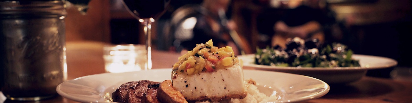
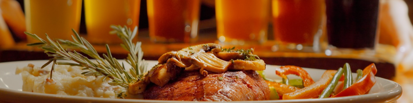
Savor the culinary delights of Sisters, Oregon! Our restaurants offer a wide variey of dining and food options, find places to eat and reserve a table today!
You will find a great variety of dining and beverage opportunities in Sisters. From simple to elegant, burgers to the best in Pacific Northwest Cuisine, you can find it in Sisters.
BUSINESS ASSISTANCE & RELOCATION
Businesses in Sisters Country prove to be pioneers of innovation. If you're looking for a great place to start or grow your business, you've come to the right place. Click here for information on becoming a Chamber member.
There are more industries in Sisters Country than meet the eye! Sisters is a quietly emerging economic center for small and mid-sized companies in a broad range of business sectors. Businesses in the industries of BioScience, TelCom, Power, Green Energy, High Tech and Software, Industrial Arts, Wood Products, Media, Outdoor Equipment, Design, Art and Music have already discovered Sisters.
The surrounding natural environment provides a spectacular setting for the Sisters community, and there are strong connections to it for personal, social and economic purposes. Sisters has a strong tourism economy because of the spectacular natural environment, but we are also a diversified and entrepreneurial economy that includes art and culture, light industry, natural resource-based business and small retail.
This economy especially supports locally conceived and owned businesses that provide a wide variety of year-round family wage employment. Highly developed local leadership and an active informed citizenry make Sisters a fine example of self-sufficiency.
Sisters incentive programs include an enterprise zone, incentives and discounts, and low SDC's. It is a town with the necessary ingredients to grow business, but hasn't lost it's hometown feel. Contact the Sisters Economic Development Director through Economic Development for Central Oregon for more information. All contacts remain confidential.
Other contacts for your business questions are listed below:
| Organization | Contact | Service |
|
Economic Development for
Central Oregon (EDCO)
|
541-388-3236
800-342-4135
|
Comprehensive information and
assistance to companies relocating
to or expanding in Central Oregon.
Demographics and other statistics
|
|
COCC Small Business Development Center
|
541-383-8290
|
Confidential business counseling
Business and marketing plan
development and review Business seminars |
| Oregon Secretary of State | sos.oregon.gov | Business Registry and Search |
| State of Oregon Employment
Department (OED)
|
541-388-6070 |
Connection point for employees and
employers. Regional and statewide
labor market statistics, Oregon
unemployment Insurance administers
|
| Social Security Resource Center | ssa.gov | Social Security System |
|
The Central Oregon
Intergovernmental Council
(COIC)
|
coic.org | Business loans
Grants
Workforce skills training
|
SISTERS HISTORY
*NOTE: Contributed by Raymond R. Hatton, Author of Oregon's Sisters Country - A Portrait of its Lands, Water, People (1996) and Sisters Country Weather and Climate (1994).
Click here for a Historical Tour Brochure of The Sisters Country. (PDF)
History of Central Oregon begins in Sisters...
Long before the Sisters Country was settled, Indians trekked through the region. Old survey maps showed Indian trails, some leading towards Warm Springs, some crossing the Cascade passes of McKenzie and Santiam. In time, some of these Indian trails became the routes of wagon roads. Nineteenth-century fur trappers and explorers also traveled through the Sisters Country.
The forerunner of Sisters was Camp Polk, a short-lived military camp (from September 1865-May 1866) that had been established along Whychus Creek (formerly Squaw Creek), about three miles northeast of Sisters. Forth volunteers from Polk County, in western Oregon, camp on a mission to protect miners and settlers in the region, but were never engaged in battle. Following the abandonment of the camp, the site was homesteaded in 1870 by Samuel M. Hindman who subsequently operated a store and post office. Camp Polk was located adjacent to a wagon road that linked the Willamette Valley and Prineville.
In 1888 the post office was relocated to the John J. Smith Store, about three miles south of Camp Polk. It was proposed the post office be named "Three Sisters." Postal authorities shortened the name to "Sisters." Taking advantage of its location at the intersection of the McKenzie and Santiam roads, Sisters soon grew to become a bustling little town. For years, Sisters was a supply station for sheepmen who passed through town on their way to grazing pastures in the Cascades. Finally, in 1901, Sisters was formally established.
Contributing further to growth of Sisters was the lumber industry. Extensive tracks of pine forest prompted the siting of several sawmills in or near town. By 1930, Sisters was primarily known as a lumber-producing town and was incorporated in 1946. The population grew from less than 200 to nearly 500. Gradually, however, lumber production fell off and in 1963 the last mill in Sisters was closed and the plant subsequently dismantled. Soon thereafter the population began to decline.
Fortunately, as highways in Central Oregon were improved, tourist-related travel increased. Sisters became known as the Gateway to the Cascades - a title befitting the city today. The population stabilized as Sisters capitalized on the beauty of the area's natural environment and the early development of Black Butte Ranch. By adopting a theme for the commercial sector and with financial support of Brooks Resources, the Sisters City Council made the 1880's style storefront a part of its zoning ordinance in the early 1970s. The Sisters Area Chamber of Commerce was formed in 1974.
Over several years the landscape of the retail area was transformed and today Sisters Oregon has become recognized as a unique place to shop with its many specialty stores and galleries. Less obvious are other changes. The old mill site north of town has become an industrial park with a number of commercial establishments and light industries. Many people, seeking elbow room and mountain vistas have chosen the Sisters Country as a place to live and play.
Please visit Three Sisters Historical Society and Museum
GETTING HERE
Sisters, Oregon, the heart of Sisters Country, is located on the east side of the Cascade Mountains in Central Oregon, 101 miles SE of Portland, Oregon.
Sisters is just 20 miles NW of Bend, Oregon and 19 miles West of Redmond, Oregon. Sisters is accessible via highways 20, 22, 126 and 242.
Local Airport:
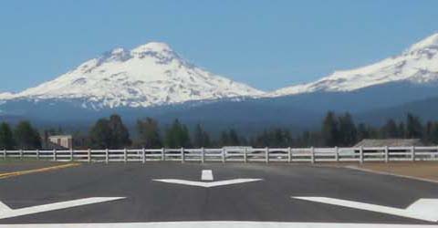
Sisters Eagle Airport (ICAO - K6K5, IATA - 6K5)
Located one mile north of Sisters. Public, VFR, open 24 hours
Owner: Benny Benson
Phone: 541-719-0602
Closest Commercial Airport:
Roberts Field, Redmond Municipal Airport is an easy 20 mile drive to the east. It offers service from Portland, Seattle, Salt Lake City, and San Francisco. New flights are happening all the time, please check with the airport for schedule.
The three major air carriers are:
Horizon/Alaska Air - 1-800-547-9308
United & United Express - 1-800-241-6522 or 541-923-5625
Delta Airlines - 1-800-221-1212
Flights depart daily to Portland International (PDX), Seattle International (SEA), San Francisco International (SFO), and Salt Lake City (SLC). Delta, United and United Express flights are operated by SkyWest Airlines.
Ground Transportation:
Rental cars are available at the Redmond airport.
Cascades East Transit has local Central Oregon routes that connect different communities throughout the region. Call Cascades East for additional information on all routes 1-866-385-8680.
Sisters Delivery and Shuttle offers reliable, responsible, and safe transportation to and from the Redmond Airport.
Tripcheck can provide transportation information on bus schedules from the valley.
Highway Information:
Check the Oregon Department of Transportation webcam links below for up-to-date highway conditions and information.
- Trip Check for Central Oregon
- Sisters Oregon Road Cam
- Santiam Pass Road Cam
- Official Map of Downtown Sisters Oregon (PDF 127K)
- Google Map

Downtown Sisters Oregon
Events
Sisters is proud of its reputation as an arts community and is home to a vast number of incredibly talented individuals. Many unique galleries featuring clay work, sculpture, photography, paintings, jewelry, fiber art and much more can be found throughout Sisters. And most recently Sisters Country is very proud of its growing collection of Public Art.
Concerts featuring every genre of music highlight Sisters' calendar of events throughout the year.
The Americana Project at Sisters schools teaches kids to appreciate, learn and perform music and create art. The My Own Two Hands celebration in April features musical performances, an art auction and displays throughout Sisters to help raise funds for the Americana Project activities.
Sisters also hosts the Sisters Folk Festival every September. Thousands of fans from around the country venture to Sisters to hear local, regional, and nationally known performers. Americana, folk and blues can be heard throughout Sisters at various venues.
The Sisters Outdoor Quilt Show, the largest outdoor quilt show in the world happens the second Saturday July every year throughout the Sisters Country. Mark your calendars!
Sisters Arts Association was formed in 2015 by a group of artists and supporters who believe that the arts are an important part of a healthy community, culture and commerce.
The Sisters School Foundation created the Sisters Starry Nights Concert Series to help close the gap in funding left by severe budget cuts in 1996 that threatened valuable programs at the Sisters schools. Its first fundraising event was the Sisters Starry Nights concert seriesand they debuted in 1997. Among the acclaimed musicians who traveled to Sisters to participate in the Starry Nights are: Lyle Lovett, Kenny Loggins, Vince Gill, Amy Grant, Michael McDonald, Deana Carter, the Nitty Gritty Dirt Band, John Hiatt, Kim Carnes, T. Graham Brown, David Wilcox, Karla Bonoff, J.D. Souther, Kenny Rankin, Nicolette Larson, Stephen Bishop, Mark Collie, Jeff Hanna, Matraca Berg, Greg Barnhill, Gary Morris, LeeAnn Womack, Christopher Cross, Hal Ketchum, and Kathy Mattea. And comedians Mack and Jamie, Wayne Cotter, Michael Davis, Don McMillan, Kevin Meaney. The Sisters Starry Nights Concert Series is currently on hiatus but there are several other opportunities to support the school district.
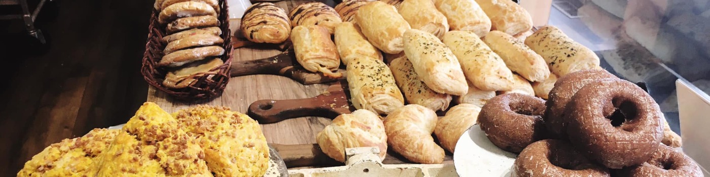
FOOD & BEVERAGE
EDUCATION IN SISTERS COUNTRY
Home of the Outlaws!
Bring your kids to Sisters Country and experience the best education in the State of Oregon. Sisters has built a reputation for outstanding schools, students and athletes. Set up a tour today by calling 541-549-8521.
The Sisters School District draws from a population of about 10,000, and consistently attracts the state's top teaching staff. The District consists of one Elementary School, a Middle School and a High School. Honors classes are offered in English and math. Advanced Placement classes are offered in US History, Calculus and Biology.
The community has a long record of financial support for local schools, recently renewing a 4-year local option levy, supporting the annual fundraising opportunities, and devoting countless hours of volunteer time on behalf of the district.
- Sisters Elementary School, Grades KG - 4
- Sisters Middle School, Grades 5 - 8
- Sisters High School, Grades 9 - 12
Other Education Opportunities:
- Cascades Academy
- Sisters Graduate Resource Organization (Sisters GRO) is an independent non-profit that partners with local donors and Sisters High School to ensure access to higher education for all SHS graduates.
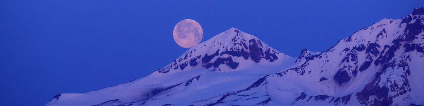
WINTER SPORTS IN SISTERS
CAMPING/RV PARKS
SEE WHAT IS HAPPENING IN SISTERS COUNTRY!
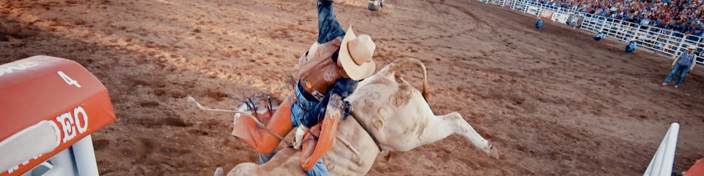
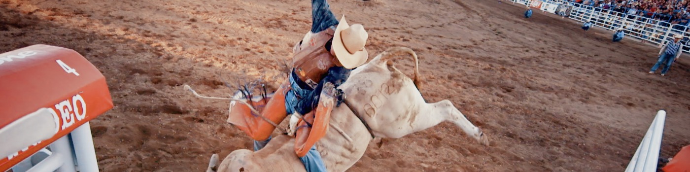
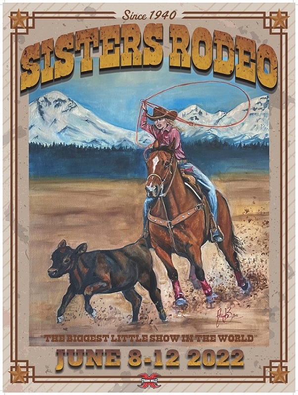
"The Biggest Little Show in the World" is always the second weekend in June.
Please join us this June 10 through 14, 2026!
Boots, bulls, and broncs will be kickin' up dust at the Sisters Rodeo grounds just east of town.
Visit the rodeo's website for ticket sales and more information: Sisters Rodeo
RESTAURANTS
COFFEE/ESPRESSO
BAKERIES/DELIS
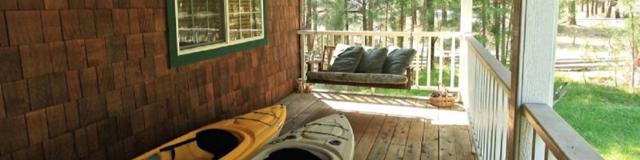
VACATION RENTALS
OTHER LODGING
ART GALLERIES
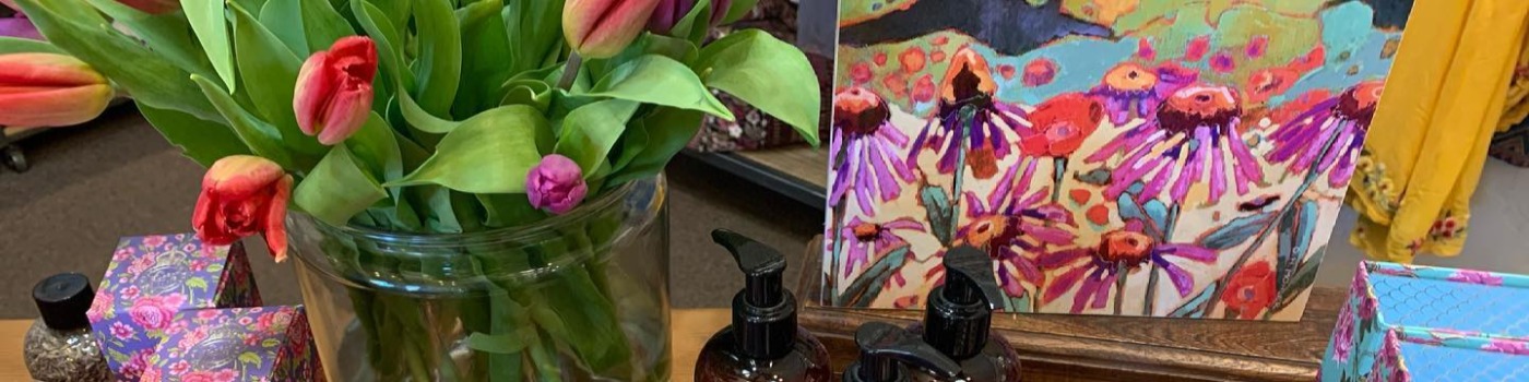
GIFTS/FLORAL
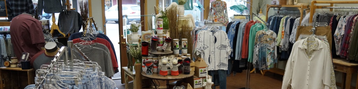
SPECIALTY SHOPS
OTHER SHOPPING
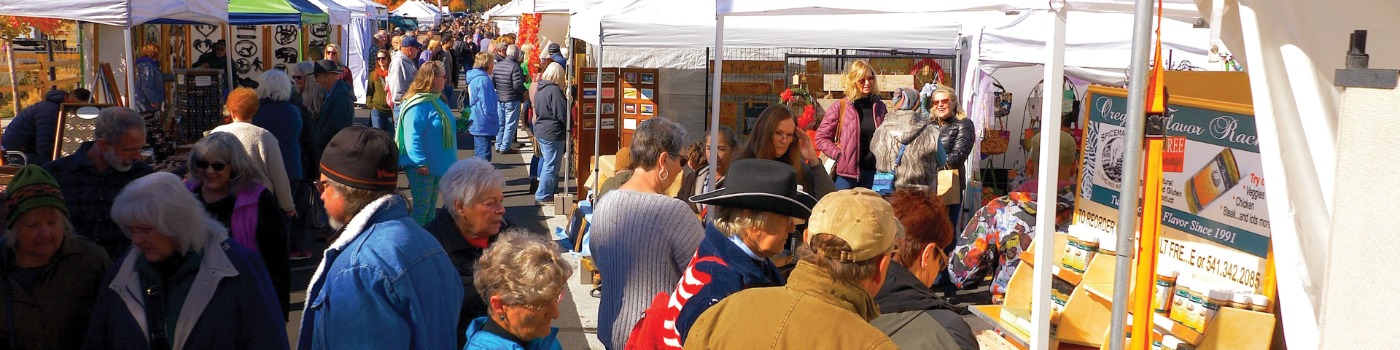
THE ANNUAL SISTERS HARVEST FAIRE
The Sisters Harvest Faire is always the second weekend in October.
Join us this October 10-11, 2026!
Interested vendors, please contact hfmanager@sisterscountry.com
Holiday Tree Lighting - November 25, 2022
Holiday Parade - November 26, 2022
Please see Sisters Park and Recreation District website for more details: www.sistersrecreation.com
HIKING
World-class outdoor adventure starts right here at the gateway to Central Oregon, beginning with these great hiking and backpacking trails all in The Sisters Country...
Easy Hikes (and Scenic too!)...The must-do's if you're in Sisters Country...
- Head of Metolius PDF (243k)
- McKenzie River Trail PDF (254k) (Focus on the Sahalie Falls/Koosah Falls Section for an easy quick experience)
- Metolius River Trail PDF (589k)
- Proxy Falls PDF (1.2mb)
- Smith Rock State Park PDF (243k)
- Suttle Lake Shoreline Trail PDF (1.2mb)
Moderate Hikes with a little climb - still great sights to see!
- Canyon Creek Meadows PDF (765k)
- Chush Falls Trail PDF (1mb)
- Green Ridge Trail PDF (670k)
- Head of Jack Creek PDF (243k) (A short drive...call 541-549-0251 for directions!)
- Tam MacArthur Rim PDF (253k)
- Three Creeks Trails PDF (264k)
Other great hikes in and about the Sisters Country include...
- Black Crater Trail PDF (1.6mb)
- Butte Loops Trail PDF (1.8mb)
- Iron Mountain PDF (254k)
- Linton Lake PDF (265k)
- Little Belknap Crater & Tenas & Benson Lakes PDF (243k)
- North & South Mathieu Lakes PDF (265k)
- Park Meadows Trail PDF (690k)
- Patjens Lake PDF (250k)
- Square Lake & Booth Lake PDF (1.7mb)
- Tenas & Benson Lakes PDF (243k)
The Peterson Ridge Trail System is located at the south edge of town just across Whychus Creek on Elm Street. This gem of a trail system has been expanded to 25 miles and offers options for hikers of all abilities. With spectacular views of the Cascades, this "stacked loop" system can entertain for days. East and West legs and a dozen connectors between them provide loop opportunities from one to twenty miles. For a fabulous 360-degree view, ride or hike the experts-only trail over Eagle Rock, only two miles from town. Recommended parking is at Village Green Park, across from the Sisters-Camp Sherman Community Fire Hall on Elm Street, where you will find restrooms and water. The trailhead is only a quarter-mile away.
Click for the Quick Reference Sisters Ranger District Summer Trail Guide (PDF)
Click for the Day-Use Guidelines (PDF)
For more backpacking and hiking information try these other great sources:
LIVING HERE
Sisters, the Ultimate Live-Work Space
If you're looking for a great place to grow your business, you've come to the right place. Sisters is a vibrant community filled with people committed to raising healthy families. Sisters has one of the best-performing school districts in the state. We're a town with the necessary ingredients for businesses to thrive, but we haven't lost our hometown feel. Sisters is a quietly emerging economic center for small and mid-sized companies in a broad range of business sectors. Click here for information on becoming a Chamber member.
- Technology
- Recreation and Resorts
- Retail
- Nutritional Products
- Cosmetics
- Specialty Manufacturing
- Home Design & Construction
- Interior Design
- Hospitality
- Automotive
- Woodworking
- Health & Wellness Products and Services
- Natural Resource Use and Development
- Professional Services
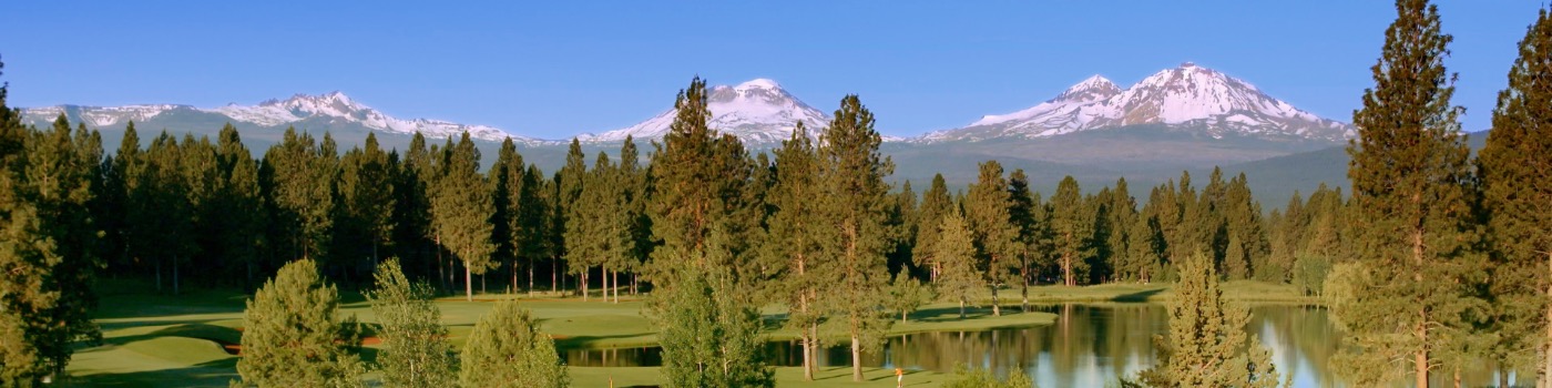
Sisters, Oregon is best known for the 1.6 million acres of national forest, 200 lakes, 10,000 foot Cascade Mountain peaks, and 500 miles of clear, fast-running trout streams that grace our Central Oregon surroundings.
See for yourself, and do it now. Contact us at the Sisters Area Chamber of Commerce and schedule a visit. Sisters won't be one of the West's best-kept secrets for long.
Stats and Facts - Sisters, Oregon at a Glance
General Information
- Population: 2,088 (with 10,000 in the trade area)
- Incorporated: 1946
- Elevation: 3187
- Land area: 1.45 sq. miles
- Density per square mile: 1,048
Demographics
- Median Age: 38.8 years
- Median HH Income: $40,952
- Percentage of family households: 66.2
- Sisters population is higher than the state average for Associates Degree and higher
Housing
- Median cost single family: $367,450
- Rent-single family: $1,000/month
Location/Transportation Sisters sits at the juncture of Highways 20, 242, and 126, key cross-Cascades route to Eugene, Salem and Portland. Sisters is also proximate to US Highway 97, a north-south artery from Canada to Northern California, and a preferred trucking route.
Mileage to:
| Bend, Oregon | -- 18 miles |
| Redmond, Oregon | -- 15 miles |
| Portland, Oregon | -- 173 miles |
| Salem, Oregon | -- 103 miles |
| Eugene, Oregon | -- 110 miles |
| Seattle, Washington | -- 328 miles |
| San Francisco, California | -- 513 miles |
Schools
- Sisters Elementary. Sisters Middle School, and Sisters High School are all available within the Sisters School District
- Central Oregon Community College and OSU-Cascades Campus are located in Bend (18 miles southeast)
Commerce Sisters boasts seven different economic sectors including Retail, Tourism, Arts & Culture, Natural Resources & Agribusiness, Light Manufacturing & Industrial, Real Estate & Development and Entrepreneurial. Each of these sectors is well represented and provides the Sisters Country with a well-balanced economic base.
Important Contacts
- City of Sisters 541-549-6022
- Sisters-Camp Sherman Rural Fire Protection District 541-549-0771
- Deschutes County Sheriff 541-693-6691
- Central Electric Cooperative 541-548-2144
- Bend Broadband 541-382-5551
- Sisters Area Chamber of Commerce 541-549-0251
Looking for comfortable accomodation in Sisters, Oregon? Our lodging resorts and hotels offer the perfect visit for your next trip. Book now and enjoy a relaxing stay!
Sisters Country has many unique options to suit your lodging needs. From a cozy romantic cabin, to a rustic camping adventure along the soothing waters of the Metolius River. Vacation rental, RV hookup, and more...Sisters Country has it all.
Still having trouble deciding on the perfect place to stay? Call our office at 541-549-0251 and one of our staff will help you with suggestions that suit your needs.
PLAY
Things to do in Sisters Country!
Get ready for an adventure in Sisters, Oregon! Hike, ski, golf, cycle and enjoy a range of fun activities in our beautiful town. Experience the best of recreation!
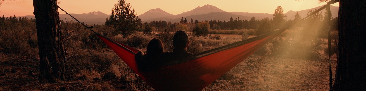
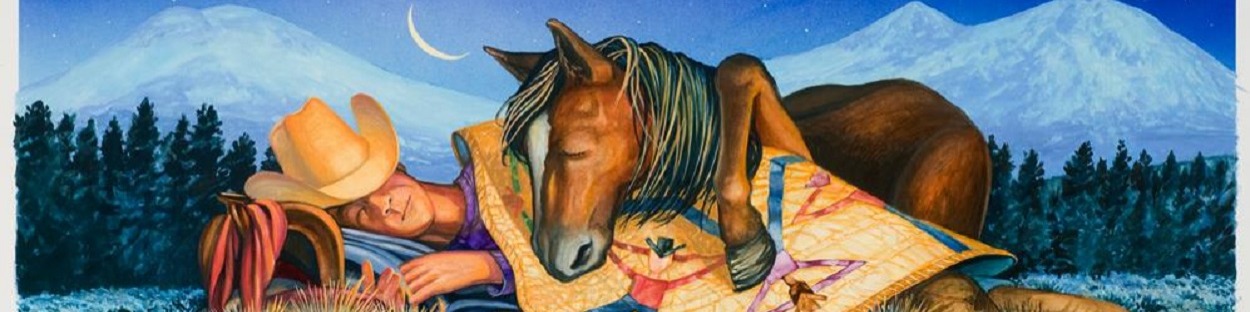
The town of Sisters, named for the towering trio of peaks (all over 10,000') to the west, is a wonderful place to live, work, play and stay, as those of us who call this home have discovered. It's a place where it's common to see someone you know nearly everywhere you go. The recreational opportunities are nearly endless, crime rate is low, and the setting is simply stunning.
The town's western theme goes deeper than the 1880's facades that gives Sisters it's unique flare. Sisters truly embodies the pioneer spirit. Sisters seems to attract an amazing number of creative, professional, action-oriented, community-minded people. They like to envision something better and work hard to achieve it, whether it's an arts incubator, a full-scale wellness center, affordable housing, or fundraising for the local schools. Residents are highly motivated, energetic and involved. The people are what make Sisters what it is - an amazing place.
The Top 20 THINGS TO DO, SEE and EXPERIENCE in Sisters Country
- Stop in at one of the many Sisters Country unique events
- Go cycling on and off the road
- Golfing at Aspen Lakes and Golfing at Black Butte Ranch
- McKenzie Pass Scenic byway and the Dee Wright Observatory
- Take a day at the spa, Shibui Spa
- Shop Downtown Sisters
- Visit the Sisters Museum
- Camp the Sisters Country
- Hike the Sisters Country
- Enjoy one of the Sisters Country's fabulous eateries
- See Camp Sherman and the head of the Metolius
- Good old fashioned Lake Swimming - Scout Lake, Suttle Lake, Lake Billy Chinook
- View the wildlife throughout Sisters Country!
- Go fly fishing
- Raft the Deschutes and McKenzie Rivers
- Visit Sisters Art Galleries
- Enjoy a game of Disc Golf (PDF Document 1MBS)
- Go birding
- Go for a horseback ride
- Just relax, stay awhile!
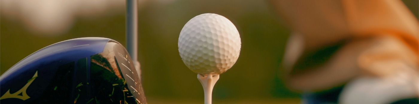
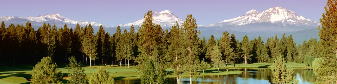
Sisters Country has several fantastic golf courses for participants of every skill level. You'll find our Central Oregon Golf Courses provide some of the most pristine scenery and vistas anywhere, with cool crisp mountain air, and better than 300 sunshiny days each year.
Looking for fun in the snow? Skiing, Snowboarding, snowshoeing, and more? It all starts right here!
Gravel Cycling Sisters Country
Check out these links to this popular new sector of cycling:
Oregon's First Gravel Scenic Bikeway
Road Cycling Sisters Country
Sisters is a SILVER-level bicycle-friendly community as designated by the League of American Bicyclists. When you come to town - bring your bike and experience our unique 1880's themed downtown from a different saddle than the pioneers used so many years ago!
Sisters Country is also home to two scenic bikeways! In cooperation with the Oregon State Parks & Recreation Department, Oregon Department of Transportation, Travel Oregon, and Cycle Oregon, the State of Oregon has officially designated Scenic Bikeways.
What is a Scenic Bikeway? Scenic Bikeways are locally initiated and state-designated cycling routes that constitute the "best of the best" in road cycling across the state known for their scenic beauty.
Routes in Sisters Country include:
- McKenzie Pass Scenic Bikeway - a beautiful ~38 mile climb up and over McKenzie Pass (open seasonally) to McKenzie Bridge. Experience this exhilarating climb to the top of Hwy 242, and enjoy the 360-degree views at Dee Wright Observatory. Typically in late spring, this route is open on the East Side to bicycle traffic only up to Dee Wright Observatory. Call 541-549-0251 to confirm snow levels.
- Sisters to Smith Rock Scenic Bikeway - this ride takes you through farmland, ranches, historic places, and much, much more. Enjoy the experience of the high desert on this 42-mile ride from downtown Sisters to the amazing Smith Rock State Park.
The Sisters Trails Alliance has more road cycling routes listed on their webpage.
We encourage folks to know the rules of the road and remember - share the road!
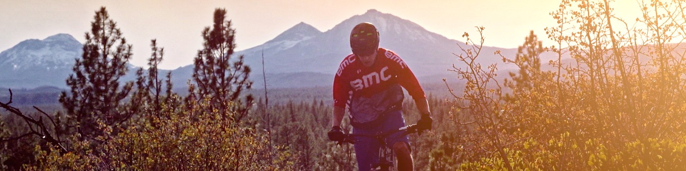
Mountain Biking Sisters Country
Sisters Country is one of the premier mountain biking regions in the state. The best known and most popular trails include the Peterson Ridge Trail System with its trailhead within the city limits, the Suttle Tie Trail between Black Butte Ranch and Suttle Lake, and the nearby McKenzie River Trail, which is widely regarded as one of the great epic bike trails in North America.
The Peterson Ridge Trail is located at the south edge of town just across Whychus Creek on Elm Street. This gem of a trail system has been expanded to 25 miles and offers options for riders of all abilities. The system can generally be characterized as playful flowing singletrack. Easier near town and more technical further out, with spectacular views of the Cascades, this "stacked loop" system can entertain for days. East and West legs and a dozen connectors between them provide loop opportunities from one to twenty miles. For a fabulous 360-degree view, ride or hike the experts-only trail over Eagle Rock, only two miles from town. Technical (expert) alternate routes are being added regularly, including the half-mile Hawk's Flight Loop, halfway up the East leg. Recommended parking is at Village Green Park, across from the Sisters-Camp Sherman Community Fire Hall on Elm Street, where you will find restrooms and water. The trailhead is only a quarter-mile away.
The Suttle Tie Trail begins 10 miles west of town past Black Butte Ranch at the intersection of George McAllister Road and Highway 20, across from the turnoff to Camp Sherman. This easy to intermediate trail climbs through the forest to Suttle Lake, crossing bridges over a couple of small creeks along the way. Cap this pleasant forest cruise with a three-mile lap around the lake trail. Another similar trail constructed in 2009 connects Suttle Lake to Camp Sherman. Refreshments can be had at both destinations.
The closest more aerobically and technically challenging option is the 99 Trail, done either as an 11-mile loop from the upper Three Creek Sno Park located about 10 miles south of town, as a shuttle from the Park Meadow trailhead nearly 20 miles back down to town, or you can ride up to Park Meadow from the sno park and make it 25. Much of the singletrack descent follows the Metolius-Windigo Trail, parts of which get heavy horse traffic in the summer. With big trees, meadows, and creeks, some of it is steep rocky "black diamond" terrain. If you want a truly epic adventure, ride up from Bend through Happy Valley, and then down the 99 to Sisters.
Ten miles out and back with a great view from a short hike at the top, the Green Ridge Trail is another segment of the Metolius-Windigo that is popular in the spring and early summer before horse traffic makes it too soft to enjoy. This trail is accessed from Green Ridge Road that turns north off Hwy. 20 just before Black Butte Ranch. Check with the Deschutes National Forest - Sisters Ranger District (541-549-7700) for detailed directions to the trailhead.
The McKenzie River Trail, one of the most renowned rides in North America, is just forty minutes away over the Santiam Pass, a 25-mile epic descent that is usually ridden as a shuttle. The first eight miles are very technical, and the scenery is spectacular throughout. Ride the bottom fifteen miles if you don't like technical trails, and soak afterwards at one of the natural hot springs.
Contact the Sisters Area Chamber of Commerce (541-549-0251), the Sisters Trails Alliance, or the Deschutes National Forest - Sisters Ranger District (541-549-7700) for more information. Of course, check out the great bike shops in Sisters Country too!
Be courteous to other trail users and enjoy!
Explore the unique small businesses of Sisters, Oregon! Our specialty shops and galleries offer a wide range of shopping, arts and culture to discover.
The shops in this 1880's western-themed town are anything but old-fashioned. Well-known artists' work grace the Sisters Country in a variety of galleries. Find your treasure at one of the antique shops or the perfect gift at one of the many specialty stores.
You will find a great variety of dining and beverage opportunities in Sisters when it comes time to satisfy your appetite or your thirst. From simple to elegant, burgers to the best in Pacific Northwest Cuisine, you can find it in Sisters.
The Sisters Country, including the charming town of Sisters, Oregon, quaint Camp Sherman, Suttle Lake, Black Butte Ranch, Aspen Lakes Golf Course and Hoodoo Ski Area, all where Central Oregon starts, is a destination like no other. The Sisters Country is an expanse of majestic and inspiring natural beauty reaching from the town of Sisters, Oregon, to the panoramic Pacific Crest Trail. Explore Central Oregon outdoor adventure and cultural experiences including the world renowned Sisters Rodeo, Sisters Folk Festival, and the Sisters Harvest Faire.
On the edge of town, the Deschutes National Forest offers a 1.6 million-acre playground laced with miles and miles of trails, rivers, lakes, wilderness areas, scenic drives and vistas, clean air, and star filled nights. Choose from rustic cabins, simple campgrounds or world class resorts, all within minutes of downtown Sisters, Oregon. Come for a visit - we guarantee you will want to kick off your boots and stay a while.
257 S Pine Street, Suite 102
Sisters, OR 97759
541-549-0251
Contact Us